|
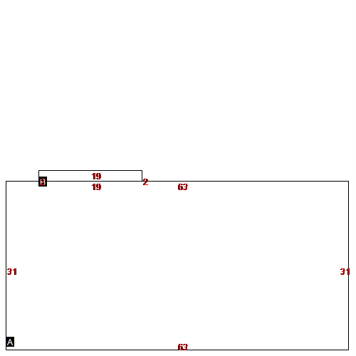
(Building 1) - Sketch for Parcel ID: 6124
 |
| Label |
Description |
Base SF |
Total SF |
| A |
MULTI-FAM APARTMNT |
1953.00 |
3906.00 |
| B |
MULTI-FAM APARTMNT |
38.00 |
38.00 |
|
|
(Building 2) - Sketch for Parcel ID: 6124
 |
| Label |
Description |
Base SF |
Total SF |
| A |
MULTI-FAM APARTMNT |
1953.00 |
3906.00 |
| B |
MULTI-FAM APARTMNT |
38.00 |
38.00 |
|
|
(Building 3) - Sketch for Parcel ID: 6124
 |
| Label |
Description |
Base SF |
Total SF |
| A |
MULTI-FAM APARTMNT |
1953.00 |
3906.00 |
| B |
MULTI-FAM APARTMNT |
38.00 |
38.00 |
|
|
(Building 4) - Sketch for Parcel ID: 6124
 |
| Label |
Description |
Base SF |
Total SF |
| A |
MULTI-FAM APARTMNT |
1953.00 |
3906.00 |
| B |
MULTI-FAM APARTMNT |
38.00 |
38.00 |
|
|
(Building 5) - Sketch for Parcel ID: 6124
 |
| Label |
Description |
Base SF |
Total SF |
| A |
MULTI-FAM APARTMNT |
1953.00 |
3906.00 |
| B |
MULTI-FAM APARTMNT |
38.00 |
38.00 |
|
|
(Building 6) - Sketch for Parcel ID: 6124
 |
| Label |
Description |
Base SF |
Total SF |
| A |
MULTI-FAM APARTMNT |
1953.00 |
3906.00 |
| B |
MULTI-FAM APARTMNT |
38.00 |
38.00 |
|
|
(Building 7) - Sketch for Parcel ID: 6124
 |
| Label |
Description |
Base SF |
Total SF |
| A |
MULTI-FAM APARTMNT |
1953.00 |
3906.00 |
| B |
MULTI-FAM APARTMNT |
38.00 |
38.00 |
|
|
(Building 8) - Sketch for Parcel ID: 6124
 |
| Label |
Description |
Base SF |
Total SF |
| A |
MULTI-FAM APARTMNT |
1953.00 |
3906.00 |
| B |
MULTI-FAM APARTMNT |
38.00 |
38.00 |
|
|
(Building 9) - Sketch for Parcel ID: 6124
 |
| Label |
Description |
Base SF |
Total SF |
| A |
MULTI-FAM APARTMNT |
1953.00 |
3906.00 |
| B |
MULTI-FAM APARTMNT |
38.00 |
38.00 |
|
|
(Building 10) - Sketch for Parcel ID: 6124
 |
| Label |
Description |
Base SF |
Total SF |
| A |
MULTI-FAM APARTMNT |
1953.00 |
3906.00 |
| B |
MULTI-FAM APARTMNT |
38.00 |
38.00 |
|
|
(Building 11) - Sketch for Parcel ID: 6124
 |
| Label |
Description |
Base SF |
Total SF |
| A |
MULTI-FAM APARTMNT |
1953.00 |
3906.00 |
| B |
MULTI-FAM APARTMNT |
38.00 |
38.00 |
|
|
(Building 12) - Sketch for Parcel ID: 6124
 |
| Label |
Description |
Base SF |
Total SF |
| A |
MULTI-FAM APARTMNT |
1953.00 |
3906.00 |
| B |
MULTI-FAM APARTMNT |
38.00 |
38.00 |
|
|
(Building 13) - Sketch for Parcel ID: 6124
 |
| Label |
Description |
Base SF |
Total SF |
| A |
MULTI-FAM APARTMNT |
1953.00 |
3906.00 |
| B |
MULTI-FAM APARTMNT |
38.00 |
38.00 |
|
|
(Building 14) - Sketch for Parcel ID: 6124
 |
| Label |
Description |
Base SF |
Total SF |
| A |
MULTI-FAM APARTMNT |
1953.00 |
3906.00 |
| B |
MULTI-FAM APARTMNT |
38.00 |
38.00 |
|
|
(Building 15) - Sketch for Parcel ID: 6124
 |
| Label |
Description |
Base SF |
Total SF |
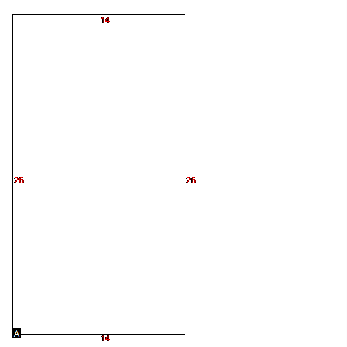
| A |
COMMERCIAL |
364.00 |
364.00 |
|
|
(Building 16) - Sketch for Parcel ID: 6124
 |
| Label |
Description |
Base SF |
Total SF |
| A |
COMMERCIAL |
364.00 |
364.00 |
|
|
|
